Underutilized Lands Inventory
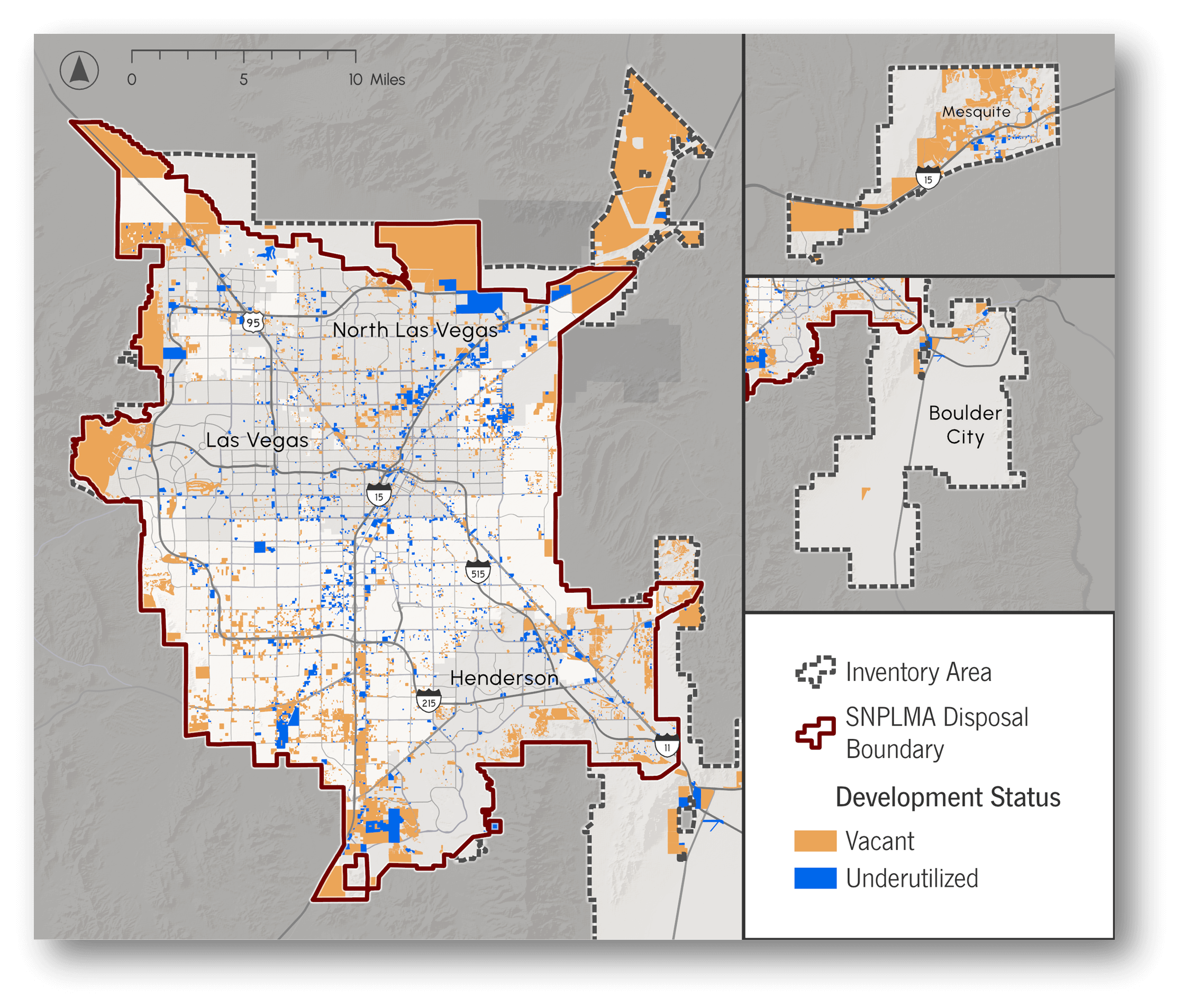
One of the goals of Southern Nevada Strong is to reinvest in current neighborhoods and build new communities that bring more opportunities and a higher quality of life for everyone. This includes more transportation options, housing units, and high-paying jobs. To help with this, the RTC created a comprehensive Underutilized Lands Inventory (12MB) to identify vacant and underutilized parcels in urbanized Clark County (Las Vegas Valley, Boulder City, and Mesquite). This will help plan how the area can grow to meet the community’s needs, especially with an expected 800,000 new people moving in over the next 25 years.
The way we grow is important! This is why, together with over 60 local experts, including real estate developers, urban planners, and economic development professionals, we developed the Underutilized Land Inventory.
What are Underutilized Lands?
Underutilized Lands are pieces of land that may not be used to their full potential. They might be empty, used for parking, or have old, rundown buildings with little economic activity. However, based on the community’s needs and market demands, they can be turned into something more useful, like new homes or businesses. Essentially, it’s land that could be used better through public/private partnerships.
Goals

Use Land Better

Encourage Job Growth

Improve Existing Neighborhoods
What We Found
A total of 78,285 acres were identified as vacant or underutilized land. Of this land, approximately 85% (69,300 acres) was classified as vacant (or empty). In comparison, the remaining 15% was deemed underutilized, meaning that most of the parcel has no buildings, and the buildings are worth less than the land.
See Final Report Here (12MB). Updated annually to reflect new data and stakeholder input.
Vacant and Underutilized Lots
A total of 31,650 tax lots were identified as vacant or underutilized. 85% was considered vacant, while the remaining 15% was underutilized.

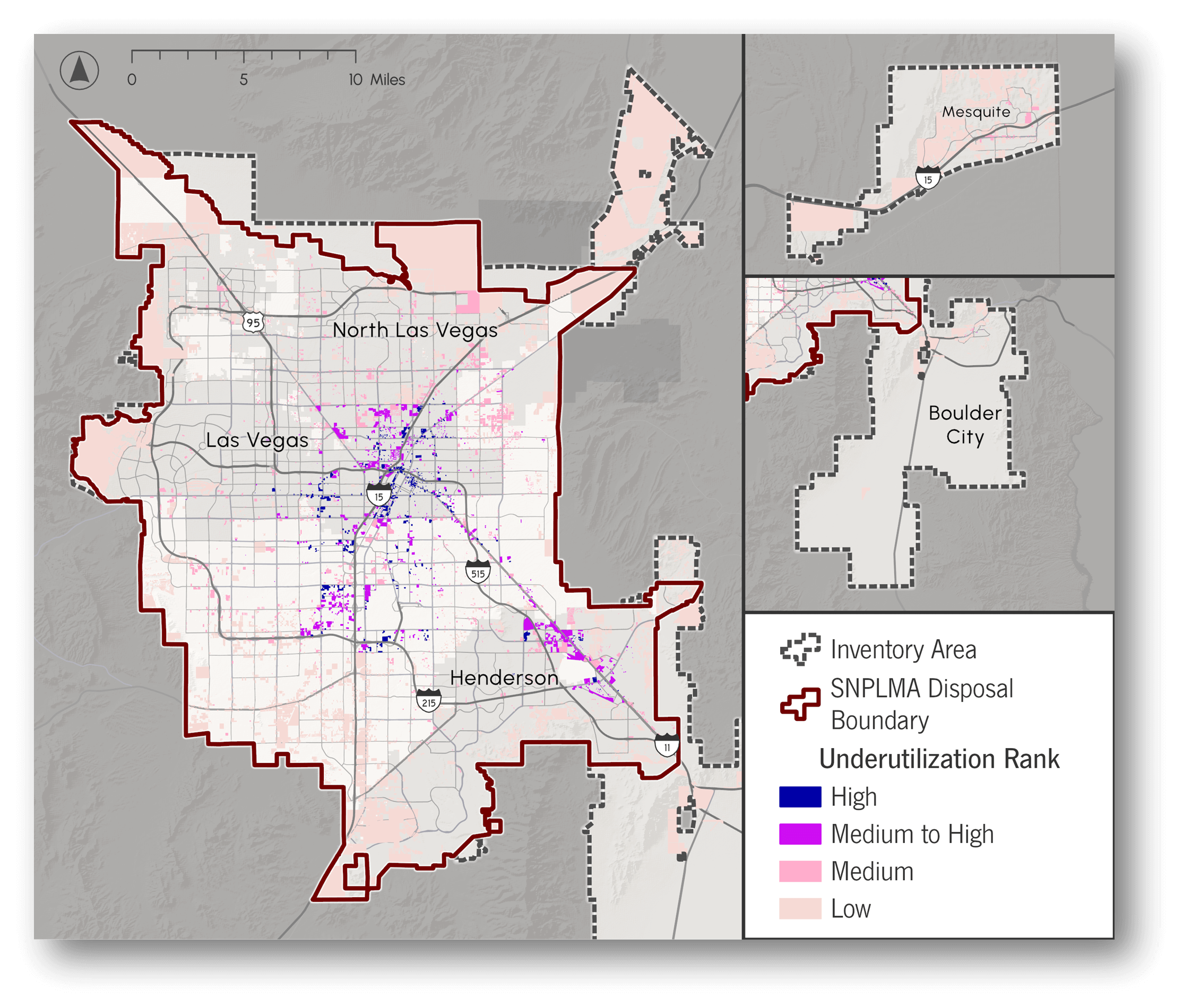
In collaborating with experts, a model was employed to score individual parcels based on various underutilized factors and used to generate a final rank for each parcel.
More than 10,000 acres were rated as having a medium or high level of underuse.
The most underused land is in central parts of the Las Vegas Valley along Boulder Highway, Maryland Parkway, and Charleston Boulevard.
Ranking Criteria and Ranked Tax Lots (as determined by stakeholders):
- Job and Population Density
- Developed Share of Land
- Economic Development Areas
- Match between Zoning and Planned Land Use Type
- Access to High-Frequency Transit
- CDC Social Vulnerability Index
- Walk Score

Click below for a presentation of earlier findings of the inventory
Next Steps
The new SNS 2050 Plan will use the inventory to model the identified parcels’ potential ability to support regional housing and employment needs for the next 25 years and compare expected regional outcomes related to how we might grow.